
Dieser Artikel wird auf Englisch angezeigt, während seine Übersetzung geprüft wird. English →
Saltwater shore · 2026-07-18 · 11 min read
Shore angle is a depth clue
How visible landform can suggest underwater slope—and why tide, sediment, charts and safety must qualify that suggestion.
ROCK CURRENT Research Notes
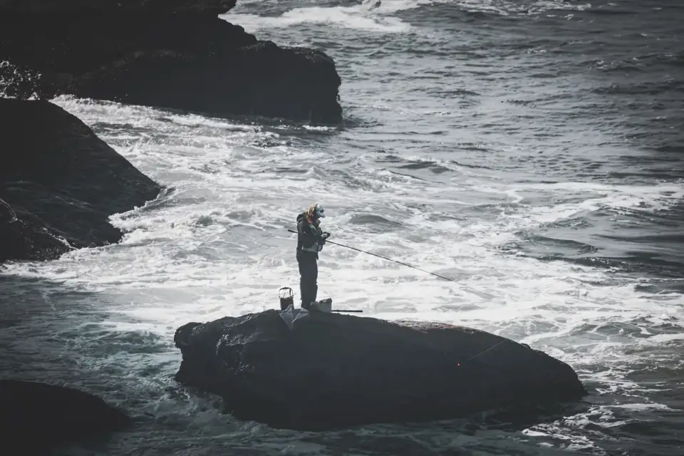 Context photograph · source record retained
The visible slope may continue—but not reliably
A steep bank, cliff or coarse shingle beach often suggests that depth may increase relatively close to shore. A broad, low beach often suggests a longer shallow approach. This is a useful first clue because landform and underwater topography can share a geological history. It is not a rule. Waves move sediment, rivers cut channels, engineering alters harbours and rock shelves can extend unseen beneath a cliff before dropping. The waterline hides discontinuities that the land above cannot reveal.
Use shore angle to form a question, not to announce a depth. Ask whether the visible slope appears to continue, flatten or intersect another feature. Then look for corroboration: breaking waves, colour change, exposed geology at a lower tide, current lines, official bathymetric information and safe, repeatable lure contact. No single clue is sufficient. Agreement among several clues makes a provisional map more credible while leaving room for the coast to contradict it.
Read the shoreline as a sequence of materials
Material changes can matter as much as angle. Fine sand is easily rearranged; shingle can form bars and troughs; bedrock may create ledges, cracks and abrupt edges. At an estuary, the river can cut a route through otherwise shallow sediment. Beside a harbour wall, dredging may create depth that the natural shore would not predict. Identify where sand becomes rock, where a retaining structure begins and where wave behaviour changes across those boundaries.
These observations organize casting angles. A cast perpendicular to a sloping beach crosses depth bands quickly. A diagonal cast can remain beside a trough or material boundary longer. A cast parallel to a wall may follow one depth but increases the importance of current, access and other users. Choose the angle according to the feature being tested. Avoid treating longer distance as automatic access to deeper or better water; distance can simply add line bow and uncertainty.
Tide moves the reference line
The shore angle you see is measured from a waterline that moves. Rising water covers bars, ledges and access routes; falling water reveals them but can strengthen flow through narrow channels or leave an angler separated from the return path. A feature that is close to the edge at one state of tide may require a very different angle later. Record the tide source and observed water movement beside every shoreline interpretation.
Current complicates the depth path further. A cross-current bows line, lifts some lures and moves others laterally before they reach the intended contour. Adding weight may restore contact, but it may also increase snag risk on a rock shelf or make a shallow return unusable. First adjust position, casting angle, working distance or timing when those changes remain safe. The aim is not contact at any cost; it is a path whose depth and line pressure remain understandable.
Safety comes before the elegant map
A steep shore can promise quick depth while offering poor footing, reflected waves and no retreat. A low beach can appear gentle while rip channels, soft sediment or rapidly moving water create other hazards. Before studying a casting line, identify the highest safe position, the dry return, changing-wave reach and any area closed by regulation. Watch multiple wave sets. The quiet interval is part of the sequence, not proof of the next wave.
Use official local weather, tide, chart and access information. On unfamiliar rock, darkness, rising swell or reduced visibility should lower ambition rather than increase reliance on a map. Fish with company where appropriate and use locally required flotation or protective equipment. If observation from a safe position cannot resolve the structure, accept the unknown. An incomplete map carried home is better field practice than a detailed map produced from an exposed position.
Convert clues into a cautious route
Build the first route from the strongest agreement: visible slope, material boundary, wave behaviour and official chart context. Select a lure and angle that can test that route without requiring unsafe distance or uncontrolled bottom contact. Mark the first repeatable evidence—change in sink time, contact, line pressure or retrieve resistance—and compare it with one adjacent route. Relative differences are enough to improve the map.
After the session, label each element as source, observation or inference. A charted contour is source information. A repeated contact point is observation. The belief that the visible bank continues underwater is inference. Keeping these categories separate protects the article and the angler from borrowed certainty. Shore angle remains useful precisely because it is modest: one clue that helps decide where to look next, never a substitute for bathymetry, local knowledge, present conditions or safe judgement.
Photographs can support the record when they are taken from a safe place and tied to time and tide, but they also need labels. Perspective compresses distance, lens choice changes apparent slope and a single frame cannot show the reach of a wave set. Pair any image with a simple sketch and written conditions rather than treating it as self-explanatory evidence. Include the direction of view and one fixed landmark so later comparisons do not depend on memory alone. On the next visit, stand in the same safe area if possible and compare the boundary, not the drama of the picture. The aim is a cautious route that can be questioned and revised, not an impressive coast that appears to prove its own depth. If the safe viewpoint changes, record that change before comparing the images. Keep the absent information visible too: water hidden by glare, contours outside the chart scale, and inaccessible edges that were never safely sampled at all.